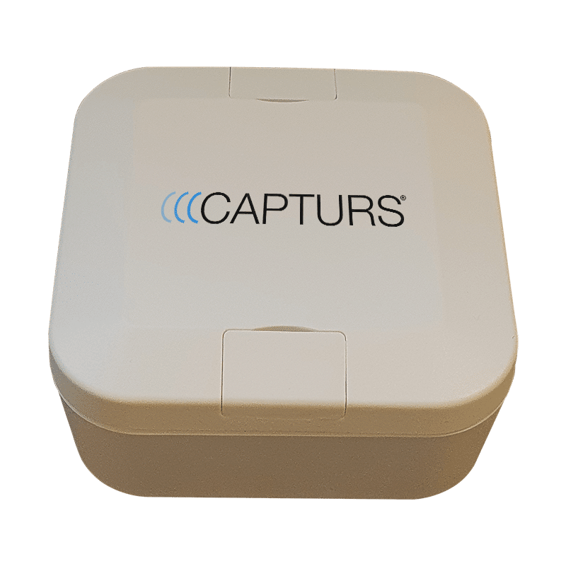
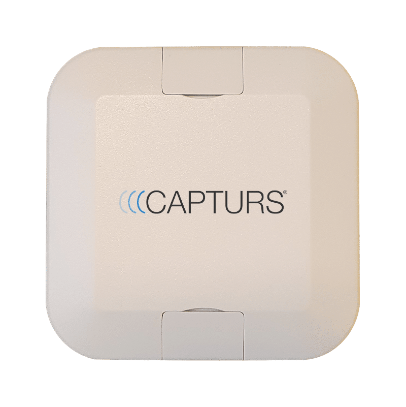
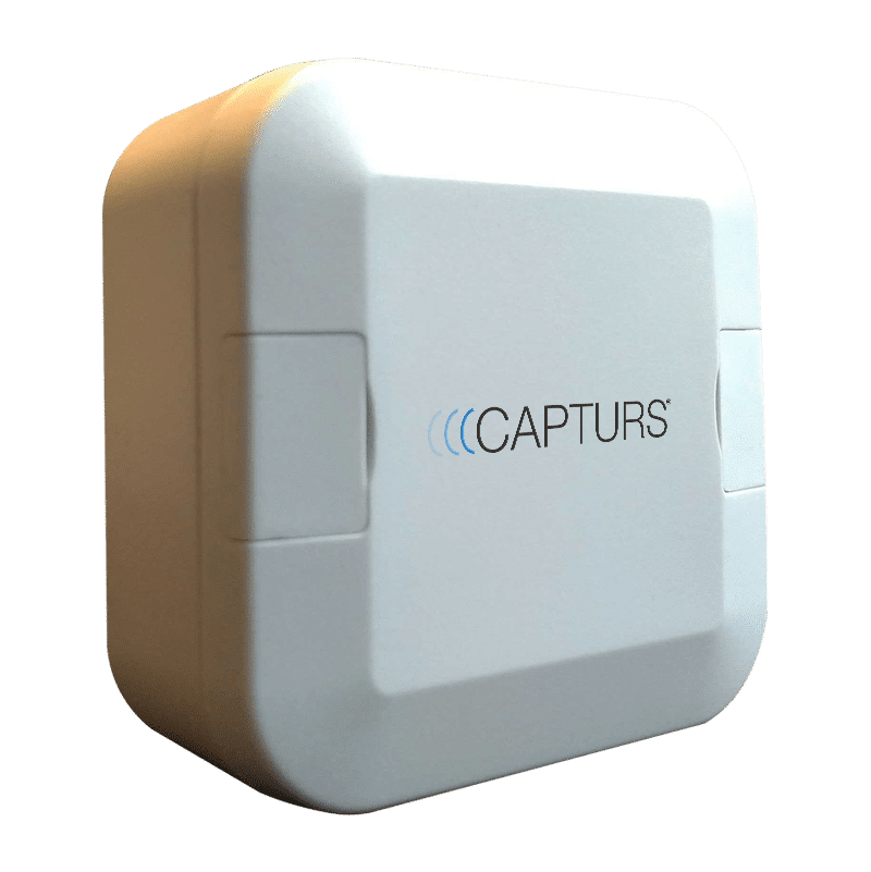
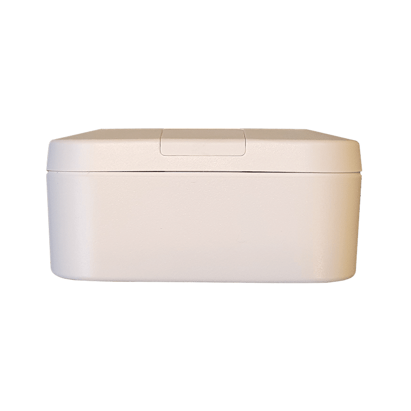
Capturs Model C GPS Tracker
79€ excl. VAT
+ choice of Capturs/Sigfox subscription from2,29€ excl. VAT/month
Or pay 4x free of charge with ![]()
Subscription at 2,29€ excl. VAT/month with 3 years commitment
Subscription at 2,69€ excl. VAT/month with 2 years commitment
Subscription at 2,99€ excl. VAT/month with 1 year commitment
● Capturs Model C GPS tracker
● Capturs/Sigfox subscription – any duration
● Access to the Capturs premium platform/application and API
● 20 SMS
● Capturs/Sigfox subscription – 1, 2 or 3 years
● Consult the Sigfox coverage map
● No obligation.
● Capturs Model C GPS tracker: 79€ excl. VAT per unit
● Capturs/Sigfox subscription: from 2,29€ excl. VAT/month
⚠ Volume discounts : contact us
Capturs Model C GPS Tracker
79€ excl. VAT
+ choice of Capturs/Sigfox subscription from 2,29€ excl. VAT/month
Or pay 4x free of charge with ![]()
Subscription at 2,29€ excl. VAT/month
3 years commitment
Subscription at 2,69€ excl. VAT/month
2 years commitment
Subscription at 2,99€ excl. VAT/month
1 year commitment
● Capturs Model C GPS tracker
● Capturs/Sigfox subscription – any duration
● Access to the Capturs premium platform/application and API
● 20 SMS
● Capturs/Sigfox subscription – 1, 2 or 3 years
● Consult the Sigfox coverage map
● No obligation.
● Capturs Model C GPS tracker: 79€ excl. VAT per unit
● Capturs/Sigfox subscription: from 2,29€ excl. VAT/month
⚠ Volume discounts : contact us

Consult
technical sheet

Contact us


1-year subscription (minimum) included: renew

Consult technical sheet
Questions? Contact us
Request a personalized quote
1-year subscription (minimum) included: renew
Volume discounts: please specify
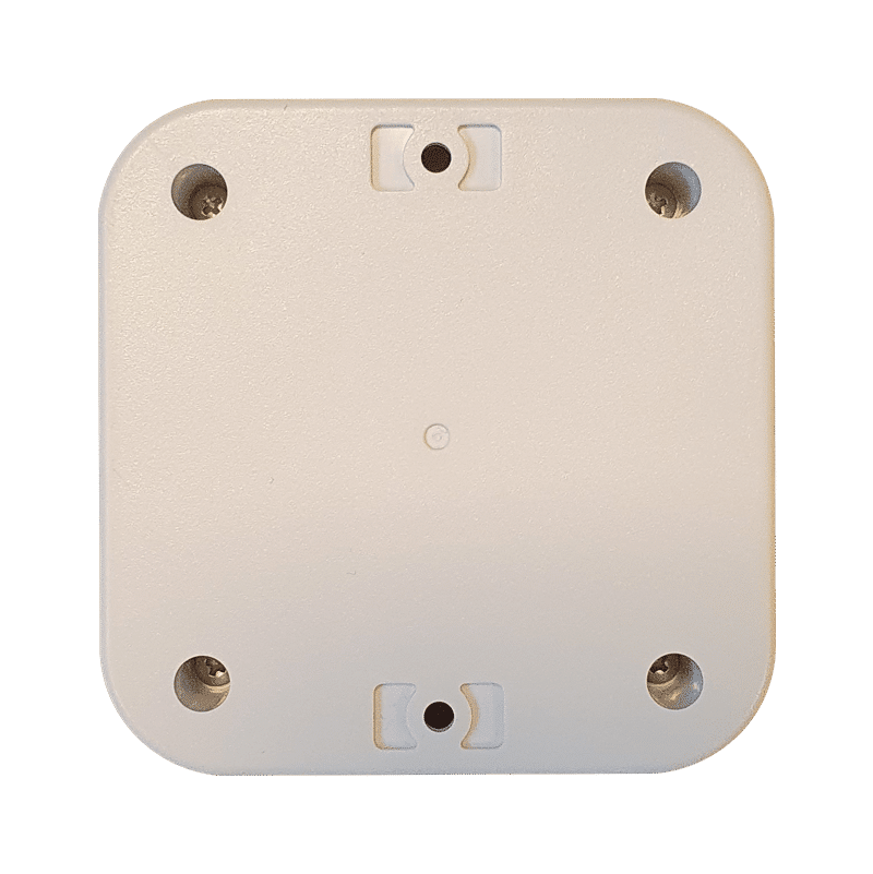
A rugged, waterproof, stand-alone GPS tracker.
The GPS tracker can be easily installed to track any type of object.
▶️ Real-time tracking
Live positions are sent at the programmed frequency. The basic setting for the Model C GPS tracker is 1 position sent every 15 minutes (trajectory accuracy of approx. 1 point every 5 minutes).
A global view lets you know the location of all your Capturs GPS trackers at the same time (regardless of model). Take advantage of a detailed view of each of your Capturs GPS trackers, providing you with information as well as all associated trajectories and stopping points, in real time on the Capturs interface (mobile application or web platform).
Positions and trajectories can be exported in GPX format from the Capturs platform.
▶️ Sigfox network
Capturs Model C GPS tracker uses the Sigfox Ultra-Narrow-Band network dedicated to the Internet of Things. When purchasing, choose the number of years of subscription required. Consult the Sigfox coverage map.
▶️ Battery life
The battery life of the Capturs Model C GPS tracker varies from several months to several years, depending on usage and the number of positions sent per day.
| Use | Battery life |
| 1 position / day | 3,5 years |
| In motion 1h / day | 1 year |
| In motion 6h / day | 3 month |
▶️ Battery
Easily replace the CR123 battery you find in stores.
▶️ Waterproofing
The GPS tracker is IP67-rated: no dust penetration, full protection against contact (dustproof). No water penetration when submerged to a depth of 1 meter for 30 minutes.
▶️ Create SMS and/or Email alerts
Configure several types of SMS/Email alerts from the Capturs interface: zone entry, zone exit, motion detection, immobility, absence, low battery, temperature. You can modify the content of alerts and enter the recipients of your choice.
▶️ Share trajectories and positions
Generate unique URLs yourself and share them with as many people as you like. Modify parameters and stay in control: activation/deactivation, deletion, duration of shared path, etc.
▶️ Generate advanced analyses
Generate automatic reports corresponding to all events on your Capturs GPS trackers: positions, alerts, zones, movements, stops, temperature, etc. Create customized dashboards and graphs. Export data in CSV format for further processing.
▶️ Zone entry and exit reports
Create your own virtual zones with our customized zone creation tool. On the map, visualize your zones in different colors. Associate these zones with alerts to receive messages when a GPS tracker enters or leaves a zone. Generate automatic zone entry/exit reports and export them for data analysis.
Length 75mm | Width 75mm | Thickness 35mm
Weight 60g
Power supply – replaceable CR123 non-rechargeable lithium battery.
Sigfox network
1 position every 15min
Monitoring of large tools or assets over long distances. Supply chain monitoring.
Can also be used to combat theft of vehicles, trailers, equipment, machinery, etc.
The Capturs platform: simple and powerful
From your computer, tablet or smartphone, access the Connect interface or the Capturs mobile application.


Find out more about the Capturs real-time tracking platform and all the associated features.
Access the Capturs platform from your smartphone (app available on Android and IoS), tablet or computer.
Manage all your GPS trackers in real time, set alerts, create infinite custom zones and generate reports for in-depth and detailed analysis.
Frequently asked questions.
To find out more about the Capturs Model C GPS tracker, contact us or consult the FAQ.
Capturs Systems Connect interface specific functions
How do I access it?
1 – On the Capturs interface, open the left menu and click on Analytics.
2 – Go to the advanced analyses: select date, zone and tracker. Scroll through the different tables and graphs by clicking on < > at the bottom of the page. Click on Google Data Studio at the bottom of this page for additional analyses.
You don’t have access to this feature? Contact support@capturs.com.
2 – Click on the button + to access to the addition of the new area.
3 – Create a specific area by moving the points that surround it, give it a name, a color and validate. Create all the areas you need this way.
4 – All the areas you created are now on the map at the top of this same page. They are also saved in the library of your account in order to reuse them by creating area alerts.
5 – The check in / check out table is at the bottom of the same page. It allows you to have precise data on the trackers that have entered or left these areas, as well as the times and dates.
2 – Select a tracker in the search bar to bring up the table.
3 – Click on

4 – You can now analyze the table and graphs that correspond to the raw data emitted by your tracker. These are doubts the data sent by the tracker to each event received by the tracker.
Points of Interest (POIs) are your own landmarks. You can easily create them by entering a street address or by pointing to the map. They will be displayed on the map if you select the “points of interest” icon on the right side of the screen. Also, easily find your points of interest on the map by filtering them using the top bar that appears when you have saved POIs.
With the “Labels” tool, customize your points of interest even better by categorizing them with colors.
When you click on 
2 – You have access to the following reports: alerts, check-in/out, raw data, stop points and analytics.
3 – You can export the data by clicking on CSV EXPORT.
The Sigfox LPWAN network.
The Sigfox network is a low-power, long-range wireless network. See the Sigfox network coverage map.

Countries included in the Sigfox subscription: Austria, Belgium, Bulgaria, Croatia, Czech Republic, Denmark, Estonia, Finland, France, Germany, Greece, Hungary, Ireland, Italy, Latvia, Liechtenstein, Lithuania, Luxembourg, Malta, Netherlands, Poland, Portugal, Romania, Spain, United Kingdom, Serbia, Slovakia, Slovenia, Sweden, Switzerland, French Guiana, French Polynesia, Guadeloupe, Martinique, Mayotte, New Caledonia, Reunion, South Africa, Botswana, Kenya, Mauritius, Nigeria, Oman, Senegal, Swaziland, United Arab Emirates.