Post – 03/09/2020
Live GPS tracking technologies, LPWAN vs GSM vs Satellite
When it comes to live outdoor tracking, the question is recurring: what is the best technology to use: GSM, satellite, LPWAN? With the network coverage issues, the frequency of data transmission, the cost of connectivity, the size of autonomy … you may be lost! The purpose of this article is to give an overview of existing technologies and detail the advantages and disadvantages of each solution. There is no bad solution, only unsuitable solutions. In particular, we will focus on the LPWAN Sigfox radio technology, used by the Capturs tags, and illustrate its particularities.
Capturs is a real-time GPS tag that uses Sigfox radio technology, a terrestrial network known as Low-Power Wide-Area Network (abbreviated LPWAN). This network allows to send in real time, on an Internet cloud, the GPS coordinates of the carrier (or the object on which it is located), and thus allow anyone to track it or receive alerts when it presses the button or when it enters or leaves predefined areas.
The Sigfox network is a terrestrial network composed of a mesh of antennas that will receive the signal sent by the tag. To operate, the transmitter must be used in an area covered by the Sigfox network. To simplify, it behaves like a GSM cell phone network, but with a much greater range and works throughout Europe regardless of the subscription (no roaming charges).
The Sigfox Network
The network coverage is given transparently on sigfox.com/coverage, and is rather faithful or even conservative (from our experience). It shows that while the Sigfox network covers a very large part of the European population, very isolated areas (mountains for example) are unsurprisingly the poor relatives. And for good reason: isolation and the absence of population reduce the need for coverage, whether LPWAN or GSM. These areas, such as the Écrins natural park in the Alps, for example, are thus network deserts. Lost in a valley bottom, with a cell phone or any device using a technology other than satellite, it will not be possible to locate you remotely in real time and track you. But then what can we use?
Different real-time tracking technologies exist, they are evolving and will continue to evolve. Before knowing which technology is the most adapted to your use case, it is important to be familiar with the existing systems, their advantages and disadvantages.
Overview of live GPS tracking technologies
We will only talk here about classical and widespread technologies in the industrial or retail world, and we will limit ourselves to systems offering “real time” GPS tracking. In particular, we will not discuss distress beacons (such as COSPAS-SARSAT or GEOSAR), which, although indispensable in many cases, are not intended for live tracking. Nor will we talk about proximity detection, DVA, ARVA… but about light portable devices, receiving the GPS position of the wearer and transmitting it on an Internet cloud, offering real-time tracking.
Let’s sweep right away a preconceived idea: there is to date no system allowing autonomous live tracking, working everywhere and sending a point every second with an autonomy of several years at a cost of less than 5 USD. The future is probably there, but it is still today in the realm of fantasy. It is necessary to distinguish several parameters on which, depending on your activity, you will have to make one or more compromises. These parameters will guide you on the choice of the solutions to be installed:
- Autonomy.
- Network coverage.
- Transmission frequency (which determines the finesse of the live tracking).
- Cost = purchase price + platform subscription price + connectivity price.
- Weight and size.
- Simplicity, completeness and quality of the functions offered (panic button, geofencing…).
Each technology has its strengths and weaknesses. But what are these technologies?
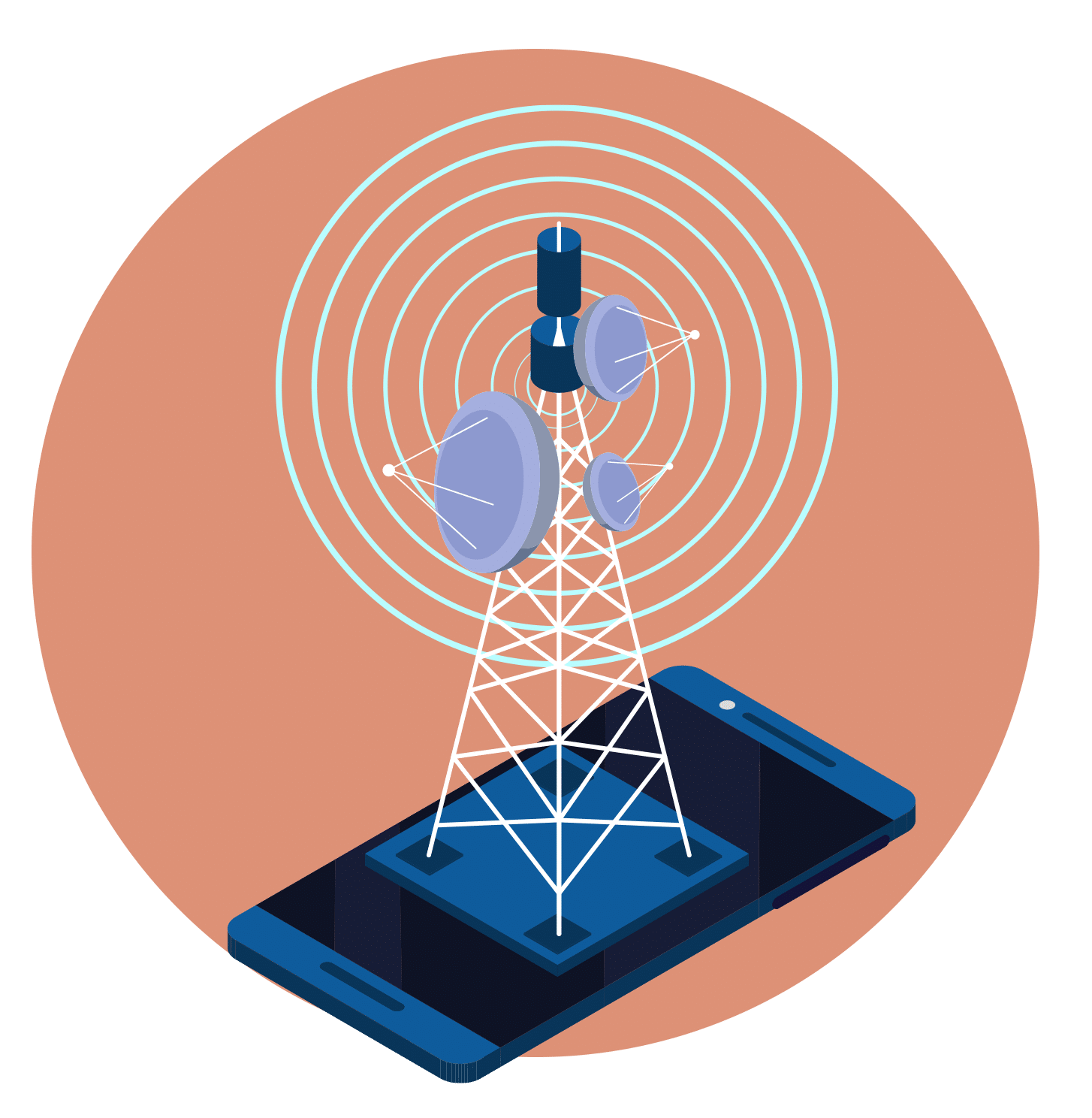
GSM
Strength: the message transmission frequency
Weakness: the autonomy
It is the most widespread network. There are two ways to use it: with a smartphone via a mobile application or with a dedicated GSM tracker. In both cases, it is necessary to have a SIM card with a data subscription to send the data. There are dedicated machine-to-machine subscriptions for this purpose at very interesting costs. On smartphones, there are dozens of mobile applications for live tracking. The interest lies in the quality of the track. Indeed, smartphones have no real limit in terms of the quantity of data sent and can relay a large number of points … to the detriment of autonomy. For continuous live tracking in parallel with other tasks, this solution is limited for several reasons: 1) autonomy: the battery will not last long, live GPS tracking being extremely consuming 2) reliability and operationality depends on the smartphone used, so an industrial company will have to provide the same smartphones and maintain them to ensure high performance of the service. On the other hand, in a managed and determined use, it is an excellent solution because the GSM network is by far the most complete. The system works anywhere in the world and is very easy to deploy without intervention. Moreover, the majority of employees already benefit from a smartphone with a GSM data subscription, so it is only a software brick to add.
Capturs offers a mobile application for live GPS tracking that you can download for free on IoS or Android, this is an excellent opportunity to test the Capturs platform.
About dedicated GSM trackers, there are many manufacturers, offering a more or less hazardous reliability. A good GSM antenna is indeed complex to develop. The fundamentals of the technology will remain the same: GSM technology consumes a lot by nature, and will require a subscription with a SIM card. In addition, to compensate for their high consumption, these devices tend to be bigger and heavier to carry larger batteries. The use of the SIM card will be more expensive than LPWAN technology (2 to 5 times the price) and on the autonomy you should not count on more than one day at an acceptable sending frequency.
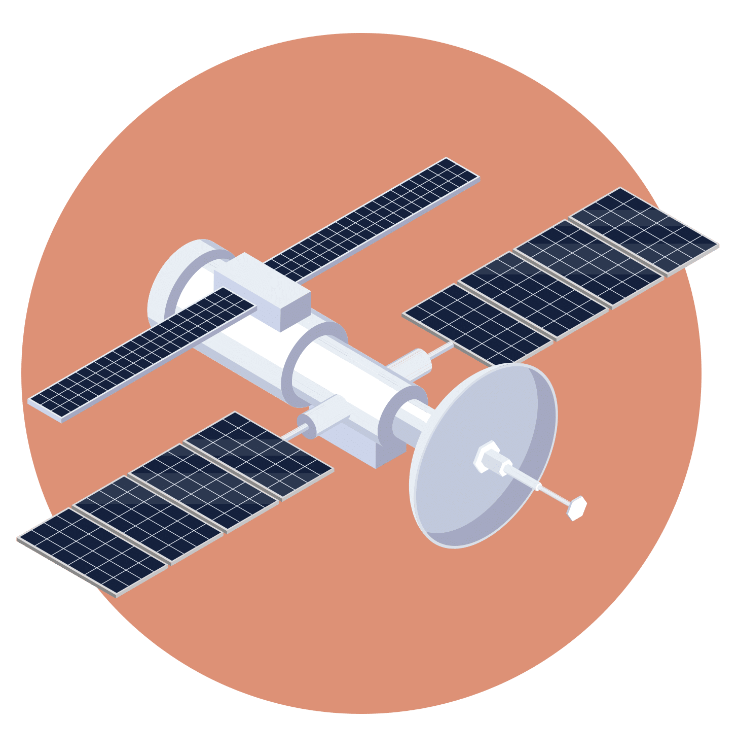
Satellite
Strength: Network coverage
Weakness: Price
The Rolls-Royce of live monitoring, including the pricing level. There are several networks of satellites circulating in low earth orbit. In our case, the two most interesting will be Iridium (used by Garmin InReach for example) or GlobalStar (used by Spot). Globalstar has a less extensive coverage and is non-existent in high latitudes (it uses 48 satellites instead of 66 at Iridium and they are oriented differently).
In all cases the satellite trackers have the huge advantage of being able to transmit from almost anywhere. The counterpart will be a very high cost. It will cost more than 400€ for a Garmin InReach transmitter but it will be necessary to pay a subscription between 200€ and 400€ per year for a complete service. This is the price to pay for this tool, which is really essential for explorers or for those for whom live tracking is a question of survival. Warning however: it was reported to us on several occasions cuts of a few hours in mountain with Spot beacons, apparently inherent to the Globalstar technology. It will be necessary to be well informed on the satellite networks and their coverage before choosing this type of technology. Moreover in the best of the cases, the frequency of transmission will be of one point every 10 min.
LPWAN (Low-Power Wide-Area Networks)
0G, the best compromise ?
It is in this category that the range of Capturs Model B and Model C trackers is positioned. This technology is new and paves the way for live tracking applications that did not exist before: very high autonomy at low cost, with a coverage globally equivalent to GSM, which is constantly expanding.
The principle is as follows: why should we send a lot of data when in many cases it is only necessary to transmit a simple status, temperature or position? The idea is based on using the right amount of energy to send the little data you need, via an adapted network that is free of any pairing or high-speed artifice (this is Low-Power). The corollary of this low power consumption is an autonomy far superior to any other system. This is exactly the opposite of the race to speed and data rate, which is why Sigfox calls its service “Zero G” as opposed to 4G or 5G.
LPWANs are terrestrial networks operating with antennas, like GSM. However, there are much less of them because they have a very long range (this is the Wide-Area). For reference, the range of a Sigfox antenna is about 50km in open field and 15km for LoRa. It can be much higher in altitude out of the relief. We regularly observe signals with a range of up to 100 to 300 km, the record at Sigfox being more than 1000 km.
Unlike GSM, LPWAN networks cleverly exploit a free radio band: the ISM band, shared with many other systems. The innovation lies in the ability to recognize the radio signature in the noise of this free band. Thus, there is no licensing cost. Fewer antennas + zero license = very low cost subscription. New applications are legion: smart remote metering, smart cities, and of course geolocation/tracking: for logistics, containers, pallets, vehicles, people, outdoor activities…
This unique infrastructure is declined in several types of networks, the best known in Europe being Sigfox and LoRa.
Sigfox or LoRa, what are the differences?
Although similar in appearance because having the same attributes: low consumption / low costs, a world separates Sigfox from LoRa :
Philosophy: Sigfox is a single network operator (there will be only one per country) but agnostic in terms of hardware: a large number of semiconductors are thus Sigfox compatible (STMicro, OnSemi, Seong Ji, Jorjin, Texas-Instruments…) while LoRa has pledged allegiance to only one American firm: Semtech, owner of the technology. Conversely, this will allow each member of the LoRa alliance to operate its own network, making LoRa suitable for private and size-limited networks.
Technology: LoRa uses a technology called “spread spectrum modulation” while Sigfox has chosen the “Ultra Narrow Band”, which consists in transmitting loudly, several times, over a very narrow radio spectrum in order to recognize the signal in the ambient noise of a theoretically very busy ISM band. LoRa allows to send more data than Sigfox and will allow to dialogue natively in both directions (uplink / downlink), but consequently will need more antennas (called gateway or base stations) to build the network. LoRa will consume more, and will be more sensitive to radio interference and local saturation. A Sigfox device will transmit without pairing, on a larger network, with a longer autonomy.
Network Coverage: As a consequence of the uniqueness of the protocol, Sigfox has a clearer picture than LoRa. Sigfox is deploying a coordinated global network, based on a single operator in each country. Today, 60 countries are covered and a clear map is available on sigfox.com/coverage. In addition, Sigfox provides back-up antennas allowing everyone to extend the network in areas not covered. The Sigfox network is being expanded and coverage of desert areas by nano-satellites is also planned. On the LoRa side, there is no centralized operator, everyone has in theory the capacity to deploy its own network, but beware: it is a real challenge to install and operate a network. It is often mistakenly believed that creating and managing one’s own network will save connectivity costs. This is a miscalculation: the installation and maintenance costs of an IoT network will be much higher than the connectivity costs of an existing global network because it is a technically complex subject. Would you have the idea of deploying your own phone network? It is therefore important to know what you want to do and to make a good business plan. LoRa will therefore be aimed at private, corporate or limited size networks.
Roaming: Sigfox is in a way a unique, global network. Whether you are in France, Italy, Denmark, Russia or the United Arab Emirates, roaming is provided seamlessly at no extra cost. Your GPS tracker will work everywhere in Europe and in all other countries of the world covered by the network. And in practice it works very well, as promised by Sigfox. It’s harder to say with LoRa, which to do the same thing should in theory rely on partnerships between operators, as with GSM. Moreover, in France there are two LoRa networks, backed by two historical operators, whereas there is only one Sigfox operator.
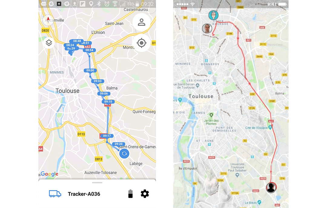
Below is the same route taken by a vehicle: on the left is a LoRa beacon (Invoxia Roadie) and on the right is Sigfox (Capturs). Almost no difference.
Which solution to choose ?
Let’s go back to our initial question: why use a Sigfox tag even if the coverage is not complete and white areas remain. Our message is that there is not one technology better than another but that they all correspond to different use cases.
The first question you need to ask yourself is “What use of live tracking do I want to make? ” Logistics, attendance management, security, workforce management, production, track & trace … ? Depending on the case, you will choose one technology or another. If it is about safety, satellite beacons running on an Iridium network will probably be the best option. This represents a cost, which must be invested, because safety is priceless. We repeat, you will not have an unfailing communication on the GSM, Sigfox or LoRa network.
Then there is the budget issue. Satellite trackers are very expensive and are not within the range of all budgets. The choice remains between LPWAN or GSM. In isolated areas, the GSM network is not really better equipped than the Sigfox network. In addition, you already use GSM with your cell phone, so there is no real interest in duplicating it by using a dedicated GSM beacon (except for a little more autonomy), because it will use the same network and will therefore have the same weaknesses as your phone.
Complementarity: LPWAN remains… but which one? Sigfox or LoRa? For the time being and until proven otherwise, in isolated areas Sigfox will generally be much better than LoRa. This is where the choice becomes relevant! In many cases the Sigfox network will work (in altitude for example). In aircraft out of the relief the coverage is almost total. Sometimes some valleys will also benefit from coverage of opportunity, effects of edges of antennas placed very far in the cities, the valleys sometimes have the role of “waveguide”. Moreover Sigfox will be able to cover areas not covered by GSM and vice versa.
Choosing to use Sigfox trackers, as Capturs, in addition to keeping one’s mobile phone, whose battery will be used sparingly, will increase the probability of being able to send a position thanks to the complementarity of the networks while benefiting from the best of both worlds. In our opinion, this is a relevant and low-cost alternative to satellites. It is better to put all the chances on our side by multiplying the technologies. In addition to this, a Capturs tracker will benefit from an autonomy that is unreachable by the smartphone.
As a result, many Capturs users prefer to have a solution that provides them with additional coverage rather than nothing at all. The rationale is that it is better to be able to find a person or an asset thanks to intermittent positions (which make it possible to guess the trajectory followed and the direction) rather than to have no clues at all. This is also the approach of the PGHM (Peloton de Gendarmerie de Haute Montagne) which is currently evaluating our system.
Last good reason to get equipped, the Sigfox network is evolving and it is even possible to improve the coverage by placing antennas in a specific location (on a factory, an industrial site, an oil rig…). No mystery: the more the network is used, the more the coverage will evolve. A good practice to adopt when choosing your IoT tracking solution: know your equipment. Systematically check the network coverage, the necessary hardware autonomy, the target cost.
It’s up to you to make the right choice, knowing that no current system can do everything. All is a question of compromise to be made on the use case. This deserves a real reflection supervised by professionals.
Check other posts:
How much does a GPS tracker for car or vehicle cost?
When companies or individuals need to geolocate a car, a vehicle or a fleet of vehicles, one of the first questions asked concerns the cost of the solution: "What is the cost of a GPS tracker?" "Is there a subscription to pay?", and specifically for companies: "What...
How to track a fleet of vehicles legally? Track a company vehicle: the legal steps.
In companies, and more particularly when the company's activity requires a global monitoring of the fleet of vehicles, a practice is gradually becoming widespread. It is the use of GPS trackers for cars, also installed inside scooters, trucks, utilities, construction...
A GPS tracker without a subscription?
A GPS tracker without a subscription?Article - 23/05/2022Can a real-time GPS tracker really be subscription-free? What are the uses for which it is possible to use a GPS tracker without a subscription?When searching for a GPS tracker, the consumer is aware of the...

